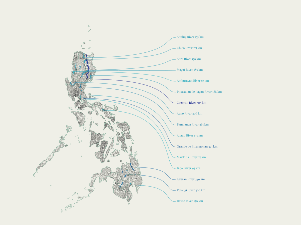
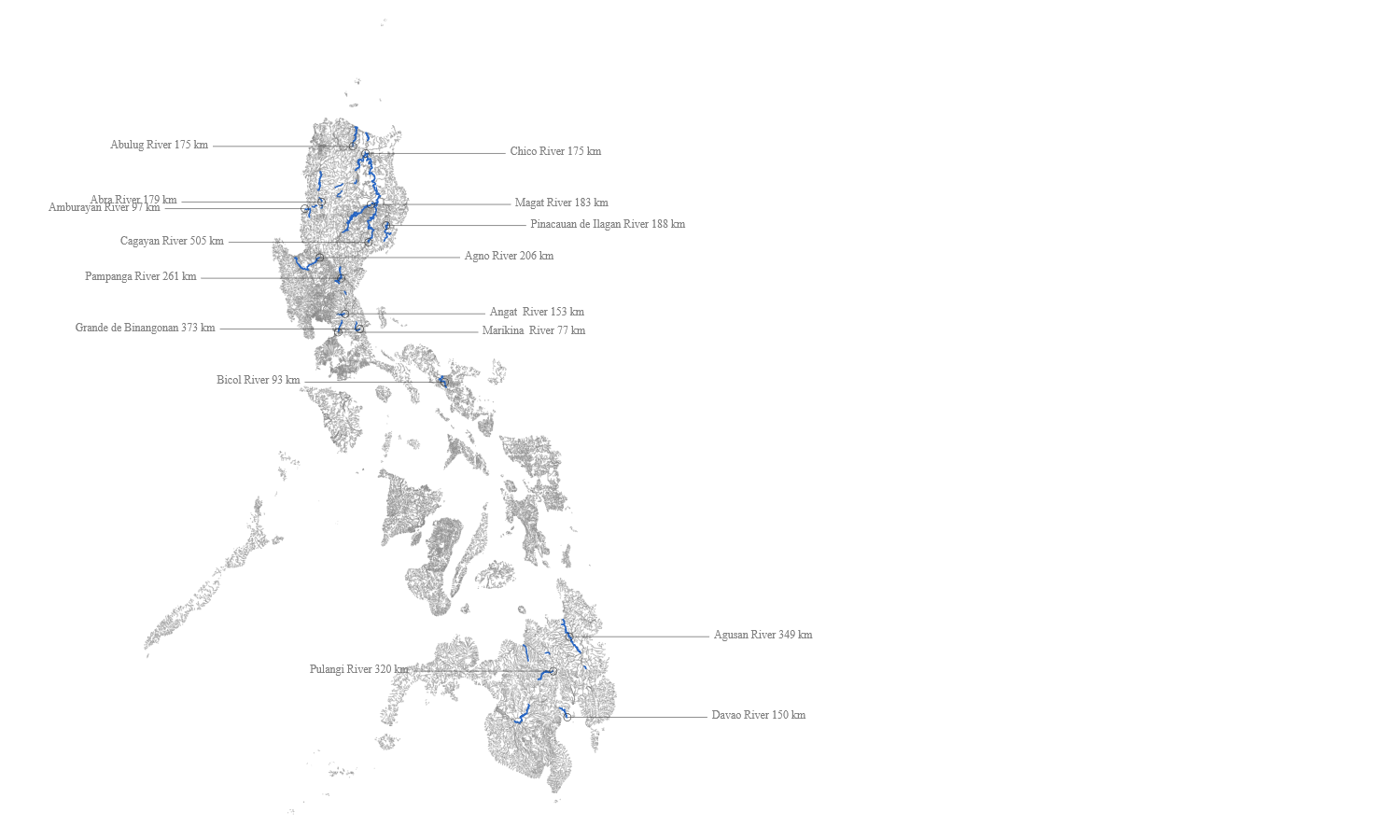
The Philippines has one of the most intricate river networks in Southeast Asia, yet most maps reduce it to a handful of named waterways. This piece renders the full network — thousands of segments — using a minimalist dark palette that lets density do the storytelling.
Luzon’s northern highlands reveal themselves as a dense tangle of drainage lines feeding into the Central Plain. Mindanao’s scale becomes apparent. The Visayas, fragmented by sea, show each island as its own hydrological system.

Highlights
- Full national hydrological dataset — not a curated selection
- Line weight varies by stream order, giving visual hierarchy without labels
- Dark minimalist palette makes density the primary visual variable
- Each major island group tells a geologically distinct story